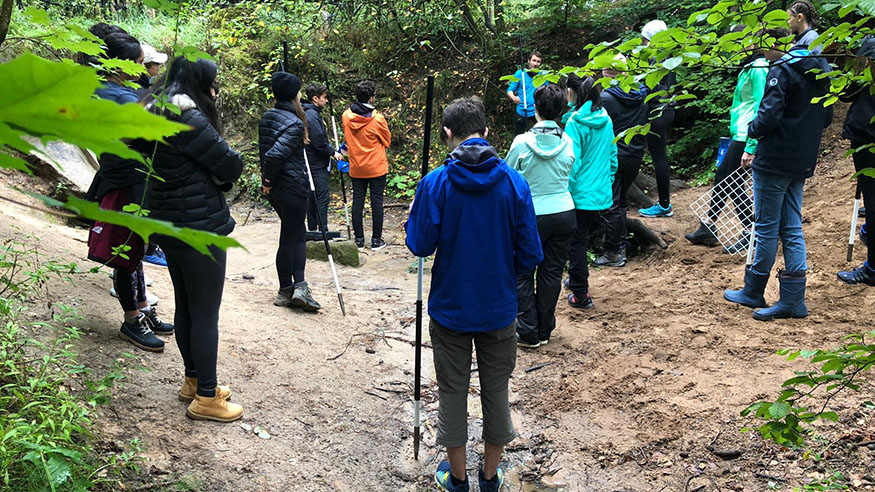
As part of the Diploma Programme, last week the Geography students actively engaged with outdoor learning to collect primary data from Indianer Schlucht, Uttenreuth.
This is a core part of the Diploma Programme syllabus to enable students to directly apply geographic and geological theory through practical skills. Naturally, the current scenario has presented some challenges and limitations to field work but it has given us the opportunity to appreciate, explore, and investigate our local area in depth. This is something that the Early Years and Elementary School students are beginning to embrace in their Outdoor Learning lessons; hopefully some cross-curricular connections between Diploma Programme and International Primary Curriculum can enrich our appreciation and understanding of the environment around us.
Grade 11 and 12 Geographers have designed methods to collect data in order to investigate the stability of the slopes, the cause of erosion and the change in physical characteristics in Indianer Schlucht. Students are now processing, presenting and statistically analyzing data to prove the hypotheses that they have individually designed. Thankfully, Mother Nature was on our side, despite the determination of meteorologist’s reports to forecast wet and muddy conditions, our data collection session proceeded without the use of waterproof clothing.
Anyone interested in reading the final reports on the Indianer Schlucht is welcome to contact me in the spring. I am sure that the DP Students will willingly share their findings.
Scott Simpson
Geography Teacher